Geography of japan
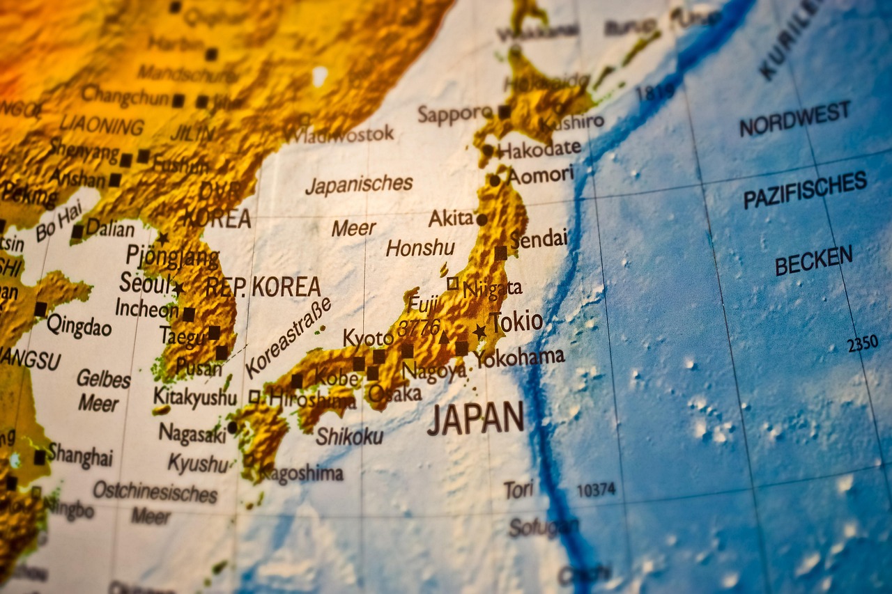
Japan is an archipelago nation in East Asia comprised of four main islands—Honshu, Hokkaido, Kyushu, and Shikoku—along with thousands of smaller islands situated along the Pacific coast. The country's terrain is roughly 70–80% mountainous and heavily forested, featuring the famous, active volcano Mount Fuji as its highest peak at 3,776 meters. Due to this rugged landscape, the majority of the population is concentrated in dense urban areas on coastal plains, such as the Kanto Plain. Located on the Pacific Ring of Fire, Japan experiences frequent earthquakes, volcanic activity, and, during late summer, typhoons. The surrounding seas are rich in marine life due to the meeting of warm and cold currents. Japan’s geography also includes many short, fast-flowing rivers and a stunning coastline that stretches for over 29,000 kilometers.
Japan is a mountainous archipelago located on the Pacific Ring of Fire, characterized by four main islands, seismic activity, and densely populated coastal plains. Tokyo, situated on Honshu’s Kanto Plain by Tokyo Bay, is a sprawling metropolis of flat, reclaimed land and western hills. Cities are predominantly coastal, combining industrial, commercial, and residential zones.
- Archipelago
- Japan is an arc-shaped archipelago consisting of over 14,000 islands extending along the Pacific coast of East Asia. The four largest, often called the home islands, are Honshu, Hokkaido, Kyushu, and Shikoku. This chain stretches for over 3,000 km, leading to diverse climatic conditions.
- Ring of Fire
- Situated in the Pacific "Ring of Fire," Japan is located where several tectonic plates meet, causing high seismic activity. This location results in over 1,000 earthquakes occurring every year, as well as over 100 active volcanoes. The volcanic activity is responsible for shaping the country's rugged landscape and providing numerous hot springs, or onsen.
- Mount Fuji
- Mount Fuji is an iconic, cone-shaped volcano that serves as the highest peak in Japan at 3,776 meters. It is considered a sacred symbol of the country, located on the main island of Honshu, and last erupted in 1707. The mountain is part of the extensive Japan Alps, which form the backbone of the archipelago.
- Honshu
- Honshu is the largest and most populous of Japan's four main islands, often referred to as the mainland. It contains many of Japan's major cities, including Tokyo, Osaka, and Kyoto. The central part of the island is dominated by the steep, forested Japan Alps
- Coastal Plains
- Although Japan is roughly 70-80% mountainous, the majority of the population lives along the flat, narrow coastal plains. The Kanto Plain, which surrounds Tokyo, is the largest of these plains and is essential for both urban life and agriculture. Because of the mountainous interior, these limited plains are highly densely populated.